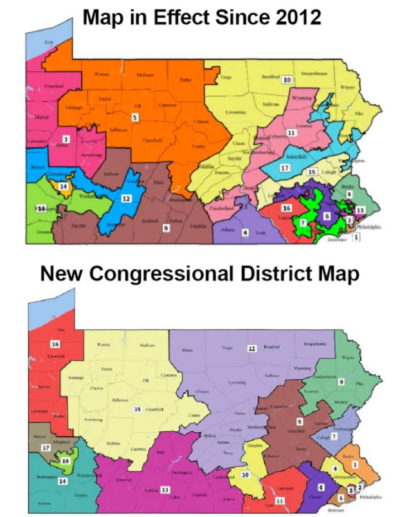
The Pennsylvania Supreme Court has released a new congressional district map and in it comes a big change for Butler County.
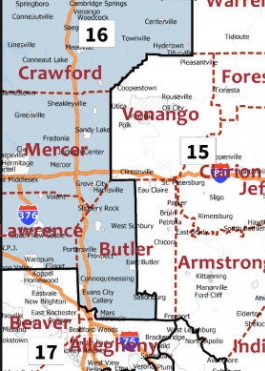
Butler has previously all been included under the 3rd Congressional District, which is currently represented by U.S. Rep. Mike Kelly, a Republican, of Butler. Under the new map, Butler County would be split into three different districts.
Most of the townships in the eastern part of the county fall into the 15th Congressional District, along with Armstrong, Clarion, and Venango counties among others, stretching as far east to Centre County.
Most of the western portion of the county falls into the 16th Congressional District, along with Lawrence, Mercer and Crawford counties and stretching up to Erie.
A portion of southwestern Butler County, a part of Cranberry Township, would be lumped into the new 17th Congressional District, along with Beaver County and the northern part of Allegheny.
Republicans in the Pennsylvania legislature have said they intend to challenge the new maps in federal court. The map, if it stays, will replace the old Republican-drawn maps in time of the state’s May primary.
Read more here.
The new map released by the Pa. Supreme Court puts the eastern part of Butler County (Buffalo, Oakland and Summit townships and Chicora, Bruin and Petrolia boroughs) in the 15th District; the western part of Butler County falls in the 16th District; a part of Cranberry Township falls into the 17th District.


The post New Map Splits Butler County Into 3 Districts appeared first on ButlerRadio.com – Butler, PA.

